User Stories
The concept of a “Map Whiteboard” was originally conceived as a “Google Docs for Maps”. To understand why that is useful and how it adds value to existing processes, we start by describing three user stories. Each story describes how the concept fits into an existing process, augments it, and improves the quality, timeliness or costs relative to the present situation.
Stand-in replacement for physical planning meetings
The County Council is developing a new spatial plan for the future development of commerce, industry in Montgomery County.
This work is carried out in close cooperation with state sectoral authorities for road infrastructure, railways, airport,
seaports and environment. Furthermore, the work involves the major urbanities of Greenhill, New Town and the rural district of Mountpleasant.
The work is carried out as a combination of one-on-one meetings between the county’s planning department and each of the other stakeholders
as well as joint meetings with many stakeholders present.
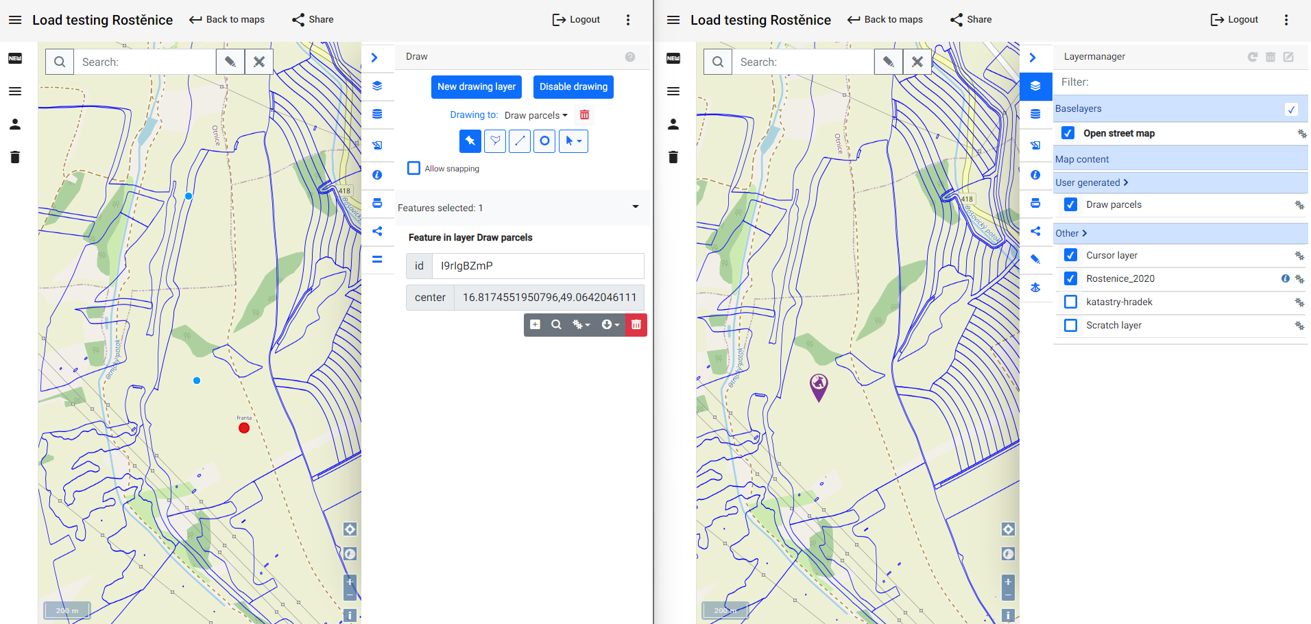
By utilizing Map Whiteboard technology, Montgomery County will enable all parties to share a common map view where everybody can add their own
information from their corporate GIS systems and where everybody will have a cursor that is visible to all the others. That way each stakeholder
can indicate to the others issues. Furthermore, all stakeholders can draw points, lines and polygons on the map and assign attributes and visual
styles to them. This enables the resolution of issues in the meetings that otherwise would have taken numerous rounds between the stakeholders to get right.
The same technology will be used when processing planning permit applications from businesses and residents of Montgomery County, speeding up
the process to get a permit, thus facilitating sustainable economic growth.
Agricultural advisor interacting with farmer
The YAMHub (YetAnotherMonolithicHub) project has developed a state-of-the art technical platform that is capable of harnessing EO and remote sensing data from a plethora of different sources for agricultural decision making on a very detailed level. YAMHub intends the tool to be used by Farmer Brown.
But, in its eagerness to provide a sophisticated tool, YAMHub partners have overlooked the fact that Farmer Brown does not hold a double PhD in data sciences, does not possess a super computer and would be using this tool at the very maximum 10 times in a year.
Thus, YAMHub relies on man-in-the-middle services provided by regional and local agricultural advisors who will use the platform on a regular basis as they each serve a multitude of farmers and agricultural businesses. Williams AgriConsult is one such agricultural advisory business.
They use YAMHub to conduct high resolution spatial analysis for their client farms - but when the analysis are done, they require to discuss the results and how to apply them to the specific farm together with the farmer. By using the Map Whiteboard technology, Williams AgriConsult and Farmer Brown collaboratively improves the input data for the model, improving its accuracy and utilizing its output on each subsequent run.
Volunteer mapper interacting with subject matter or local expertise
The planning department of Hovězí Municipality is developing a plan to transform local agricultural production from live-stock to super-crops, seeking to boost the human-nutrition output while reducing the intensity of the land-use.
For this, Hovězí requires ad-hoc data collection about current conditions and historically grown crops in the region from eldery people with good local knowledge, resident in the area. By using Map Whiteboard technology, municipal planner Jan Novak publishes a map where people can volunteer the necessary information by means of drawing on a map and specifying attributes in an electronic form. The web address is published in the local newspaper and distributed via an information campaign.
Adam Svoboda is a retired farmer with good local knowledge but a suspicious relationship to modern technology. By the help of his grandson, he is able to get online and has called Jan Novak on Skype. They are both looking at the same map and by the aid of his grandson, Adam is able to show Jan the exact location of relevant parcels and landscape features that are relevant.